The Total Geographical area under ABD is 742 Acres. River Kanh and River Saraswati form the eastern boundary of the ABD area. The boundary follows Lal Bagh road to Mhow Circle on the southern part, then towards north along MOG lines road till the T-junction with Dhar road, from where its aligns with Dhar Road till Gangwal Circle, where after it moves northwards along Netaji Subhash Marg passing Bada Ganpati Chowk and turn eastwards towards Imli Bazar Chowraha and meets River Kanh at the Nagar Nigam Square.
The area covers the administrative zone boundary of Zone no. 1 (Kila Maidan), Zone No. 2 (Raj Mohalla), Zone No. 3 (Nagar Nigam), Zone No. 11 (Nehru Stadium), and Zone No. 12 (Harsiddhi Zone). The 11 out of 85 wards are fully or partially part of the ABD area Boundary; they are namely Ward No. 6, 7, 8, 57, 58, 59, 60, 67, 68, 69, 70. Map shows coverage of different Zones & wards within the ABD area.
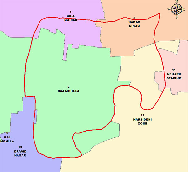 Figure: Coverage of Administrative Zones in ABD Area
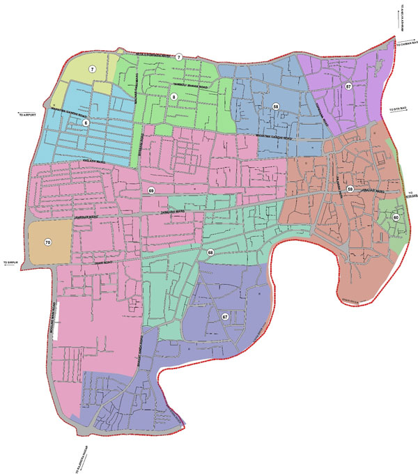 Figure: Wards in ABD Area